November 20th, 2015
Chimborazo Volcano
By Eli
"With a peak elevation of 6,268 metres (20,564 ft), Chimborazo is the highest mountain in Ecuador. It is the highest peak near the equator. Chimborazo is not the highest mountain by elevation above sea level, but its location along the equatorial bulge makes its summit the farthest point on the Earth's surface from the Earth's center."
Yesterday Asa, mom and I went on a bike tour of Chimborazo. We had to wake up at 6:00 in the morning to get on a truck that drove us all the way from Riobamba to Chimborazo. The truck ride was about an hour until we got to a pull off in the road where we took a short hike to a Polyepis Forest. Polyepis trees are the only trees that can grow at altitudes as high as we were at (we were around 4,200 meters). There are barely any polyepis trees left in Ecuador because a little over a hundred years ago the trees were harvested to extract quinine from them to help treat malaria. The reason why the trees have not grown back is because at such high altitude the trees can not grow fast. Polyepis trees have a growth rate of around 1-2 CM a year. After we saw the Forest we got back in the truck and drove to the first refuge for hikers climbing Chimborazo which is at 4,850 meters. There, Asa, mom and I went to hike to the second refuge which was around three kilometers and above 5,000 meters. Asa and I made it half way up and then had to turn around because the altitude was giving us headaches and it was hard to breathe. When we got down to the refuge, dad was there with his climbing group eating lunch and getting ready to climb Chimborazo. We sat with him for a little bit while mom and the rest of the group was hiking.
When the group got back, the bikes were ready waiting for us. We had to suit up in knee pads, elbow pads, and two pairs of gloves that were too thick to feel the handlebars. It was pretty ridiculous that we were wearing all of these pads to ride down dirt roads. I was laughing at the fact that I had on more pads to ride down dirt roads then I did when I was hitting huge jumps and riding downhill at Highland Mountain Bike Park. We started riding down from the first refuge and it was really cold because we were up so high. It was fun to ride down because they had just graded the road so the dirt was really loose and slippery. We rode downhill for about an hour before we got our first uphill. It was already around 3:30 when we got to the uphill. I started to get a headache just before the uphill. I think it was from going to bed around 11:30 and then waking up at 6:00. At the top of the uphill, we stopped for lunch but everybody had already eaten so we all laid down to rest. When we started riding again my headache just kept getting worse so I got in the truck and sat all the way back to town where we picked up the rest of the group. We got dropped off at our hostel at 7:00 and we all fell right asleep. It was a really long day and we were really tired by the end, but we had finally found some decent bikes and by the end we got some great, clear views of Chimborazo.
 |
| Vicuñas. These animals are related to llamas, but are wild. |
| | | | | | | | | | | | | | | | | | | | | | | | | | | | | | | | | | | | | | | | | | | | | | | | | | | | | | | | | | | | | | | | | | | | | | | | | | | | | | | | | | | | | | | | | | | | | | | | | | | | | | | | | | | | | | | | | | | | | | | | |
 |
| You can see the history of the eruptions by examining the different layers of the volcanic sediment near Chimborazo |
 |
| The hike up to the Polypis Forest. |
 |
| Polyepis Tree- "the paper" tree |
 |
| You can see the polyepis forest on the left. |
 |
| Hiking up to the second refuge- 5,100 meters. |
 |
| Throughout the whole day we were getting glimpses of Chimborazo. |
 |
| A cold start to the day, but geared up well for the ride! |
 |
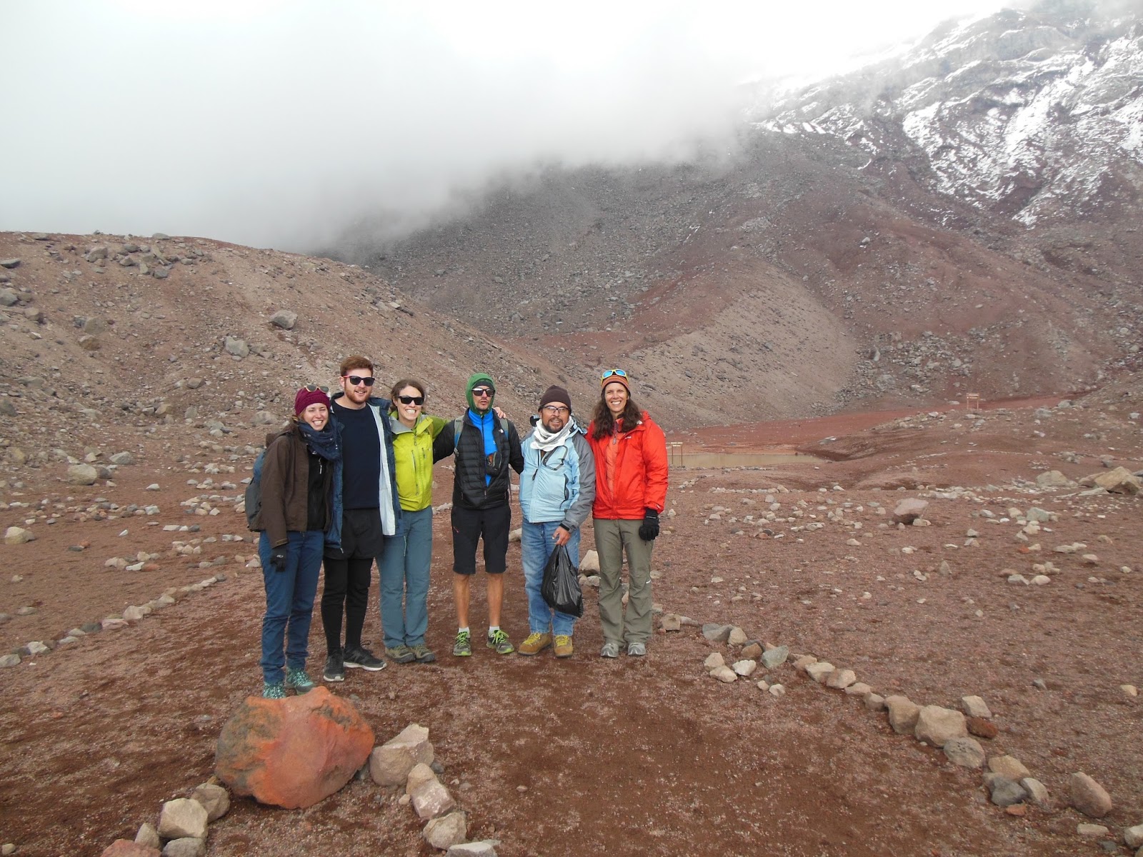
| The crew: 3 Swiss, 1 German, 1 Candadian, 3 Americans (us) and 2 Ecuadorian Guides |
 |
| Finally at the end of the day, we got a clear view. |
Brad's summit to Illiniza Norte ... AND
Chimborazo (20,546 feet)


No comments:
Post a Comment